PADDINGTON IV in a Dutch Canal in 2009

PADDINGTON IV in a Dutch Canal in 2009

Wednesday 29 June 2011

Rost - the last Island (south) in the Lofoten

Monday 27th June 2011 – Rost – the last of the Lofotens

We left Vaeroy in the mid-morning with clear skies and light winds, 60 odd miles to the east we had excellent views of the Svartisen Glacier (the one we visited after we crossed in to the arctic circle) which covers around 370 square kilometres.   
Svartisen Glacier from over 60 miles away
Ferry going into Vaeroy, as we were leaving and the Lofoten 'Wall' in the background, with the clouds above.
 We motored the 24 miles to Rost the most southerly group of islands in the Lofoten chain.   
The route in through the rocks to Rost

We had just got tied up as per our guide book to the harbour wall along a causeway between two islands, and as he tide was dropping we had hurriedly put the folding bikes in their bags ashore and these James had just assembled when a youngish man approached us and said there was a pontoon just around the corner, James said he would dispatch me with the bikes, when he said “no problem I’ll just pop them in my pick up truck and catch you on the pontoon” which he did.  It later transpired that the pontoon was his and that the cost would be no different from the town wall, which had electricity for which one paid on a credit card and rubbish bins but no notice of any berthing fee.  Steinar Greger, our Rost entrepreneur, charges NOK150 per night including electricity, no water was seen anywhere.  Steinar is the export manager for his family’s stockfish company, selling 96% of their air dried cod to Italy; apparently the island produces the best stockfish of the Lofoten, he also has a ‘pub / café’ near the pontoon and when he is available he will give guided tours of the Island which includes a visit to see the inside of the church, where he will play a few tunes on the organ.  The cost of the Island tour is NOK150.   Here is his plug – if you are ever visiting Rost, then do use his pontoon ‘Utrost Havn’ right at the very end of the harbour where he will make you very welcome.  He also has houses to let out and can be contacted by email at: sjgreger@johngreger.no or by telephone: 00 47 926 85601.
Paddington IV alongside Utrost Havn

After lunch we took the bikes to cycle round the island; in the north we identified some possible places to return to see the midnight sun, no more than about 3 miles away. 
? Curlews seen on our walk

 The early evening saw us having coffee and waffles (Norge style) at Steinar’s café.  It was here that James asked if he could get us some cod for the next day, I thought great he is planning to cook me supper for my anniversary rather than visit the local hotel for a meal out.

Soon after 11pm we headed back up to the north of the island, near the cemetery to see the midnight sun and welcome our 31st wedding anniversary in.
Midnight sun on our Anniversary Eve

Carol & the boat at 1am

Tuesday 28th June 2011 – our wedding anniversary

We awoke to rain, although James did brave the elements to visit the joker stores for fresh warm rolls and an anniversary card!  The morning was spent planning the return journey south.  At about 2pm Steinar arrived with a medium sized cod (headless) and also a saithe which we declined due to lack of fridge space and needing to fillet it and frankly I was worried about the cost as we are finding Norway very expensive.  When we tried to pay for the cod Steinar said it was a present, so we gave him a bottle of sparkling wine as a thank you.  He also said he was taking a Danish couple to see the church and for a drive around the island and there was room for us in his car, so we accept his offer of the tour and met him soon after at the café, parted with our money and were off to see the Church which has one of five triptychs (alter screen) given to Norwegian  churches by Princess Elizabeth of the Netherlands in 1520, in heartfelt gratitude to higher powers for having survived a stormy voyage to become queen to Christian II in Copenhagen.  At that time Norway was part of Denmark.  The triptych has been in at least 5 churches, surviving fires and hurricanes and other disasters which struck them, it has been restored several times and most recently between 1982- 1989.  As most church are made of wood they tend only to last for about two hundred years and this current church was consecrated in 1900.  Steinar played the organ for us and surprised us by saying he does not read music just plays by ear, no wonder he is so good at languages!
Rost Church

After the drive around the Island we went to the supermarket and re-stocked the fridge.
On returning to the boat James found me a video on the internet to watch showing me how to fillet the cod!  However, before starting on the cod the rain stopped and we rushed out on the bikes to do one of the recommended walks which started from by the airport in the north of the island, it was a 2 miles cycle ride to the beginning of the walk, made longer because the map dropped out of my jacket pocket and we had to retrace our steps for three quarters of the way to find it!  We chose to do the blue walk which took us to the highest point of the island – all of 10 metres! 
James at 10 metres - the highest part of Rostlandet
  The longer ‘red’ walk was across to an island which we had been warned about, because you risk getting cut off by the tide and we knew the tide was coming in.  Returning to the boat at 7pm I had to get to work filleting the fish, not very beautifully done as we have no really sharp knives on board but I did persuade James to cook his first meal of the voyage which was excellent as I knew it would be if he put his mind to it, but I fear for our cholesterol levels having seen how much butter he used!
The cod, before I filleted it

The finished meal!

After supper we joined the Danish couple and a few others at ‘Skomvaerkroa’, Steinar’s café for coffee and waffles.  We joked that Steinar must be very wealth as he is good at making one part with one’s cash – a real salesman.  However, it goes to prove that if you chat to people and tell them about the place and country they are more inclined to spend their money – this was certainly the case with us and really the first place this has happened in.  Whilst I think the honesty boxes or credit card machines found in most places for paying for ones berth are a good idea, especially for the little used marinas, as one feels honour bound particularly with the honesty boxes to pay up, they do not lead to any communication which can help endear the area to the visitor.

Sunday 26 June 2011

Fishing Villages of the Southern Lofoten

Friday 24th June 2011 – The fishing villages of South Lofoten

At last we were able to leave Leknes with light winds on the nose but still very misty conditions.  Our first port of call was the famous fishing village of Nusfjord on Flakstad Island, just 12.5 nm miles from Leknes.  From seaward from the north the entrance to Nusfjord is concealed it looks as though you are sailing towards a rock and it is not until you get close in that you see the route in to a small bay with the village built on 3 sides of the first bay, there is a guest pontoon with room for about 3 yachts and we were pleased to find that there was no charge for a stay of under 4 hours, otherwise it would have NOK 150.  One and a half hours was quite adequate to see the old buildings, a good slide show of fishing past and present around the area and a look in the shop, mainly items for the tourists.  Around the harbour are lots of small red rorbu (fishermen’s cabins) still used today by the cod fishermen in winter and the tourists in summer.
Nusfjord Harbour

A further 11 nm miles found us at Reine on Moskenes Island, where we took the opportunity to fuel up.  A self-service diesel pump on the pontoon and on the quay above the payment machine which took our English credit cards, it allowed you to have just under NOK 1000 before you had to repeat the procedure, but it did mean James got our fuel tank completely full.   
Reine fueling pontoon

Having fuelled up we visited the Norwegian whaler’s museum as Reine is one of the few places still involved in whaling.  There are four whaling boats working out of Reine and they are only allowed to catch minke whales, whose numbers remain strong because the minke is one of the few whales that calf every year.  We saw a film about catching whales, which have to be shot with a harpoon with an explosive tip, so the whales are killed almost instantly and if the skipper is in any doubt he carries a rifle to finish them off.  The whales are then butcher on the boat before the carcasses are returned to the sea.  The meat is left on the deck to cool before being put on ice in the hold.  The museum is small but informative and the girl at the reception also took us round explaining everything.
Reine, surrounded by mountains

The town of Reine is situated on a small flat area which is spectacularly surrounded by mountains.  On leaving Reine we decided to spend the night in the fjord behind, which had been recommended to us.  We held out breath as we motored under the 18 metre bridge and 7 miles to the end of the Kirkefjord which is also dominated by tall mountains on 3 sides, the tops were all disappearing into mist.  We opted to anchor in 8 metres with 60 metres of chain out – James does not believe in keeping chain in the chain locker!  However, when he went to put the snubber on the chain to stop it clanking during the night he found that the anchor windlass up button would not work, down was fine!  James was not happy stay on the anchor knowing that he could not get it up in hurry should he need to, so he had to pull up 60 metres of chain by hand – one way of strengthening the arm muscles! 
The staging on the Kirkefjord we tied up to.

We then motored back to a small hamlet and moored alongside a disused jetty – James had watch out for rotten planks when he went ashore and we had to check during the night that the fenders came up on the rising tide okay and did not get stuck under a beam.  During the night I suddenly became very itchy and found that I had a ‘nettle’ rash on my body, which brought back memories of the anaphylactic reaction I had in 2006, so I hurriedly took some antihistamines and all has since been fine, but I can’t pin point anything new that I had eaten or been near to cause the reaction.
Total distance motored: 32 nm

Saturday 25th June 2011 – Visit to A – the first village in the atlas index!

We left the Kirkefjord for the short motor around to Sorvagen where there is a guest pontoon and we had been told was a good place to visit A from. 
Sorvagen guest pontoon, mountains in the mist.

On arrival the first job was to try and sort out the anchor windlass.  James had spoken to his boat electrician so he had instructions on where to look for the problem.  Firstly, he double checked that neither of the anchor windlass controls would work and put WD40 down the plug with no success.  Then he had to get under our bed, which is no mean feat, having done that he says he had only really just looked at the wiring to see that it was all in place, when we tried the anchor windlass control again and hey presto it was working.  James says that he dislikes a boat that does not work but one that only half works is even more annoying!

After lunch we cycled over to A and went round the Lofoten Stockfish Museum which is dedicated to the history of the production and sale of Norway’s oldest export commodity, dried fish.  Italy is the biggest importer of Norwegian stockfish – dried cod and the heads are sold to Nigeria for use in soups.  By the time we came out of the fish museum it was raining so we had a quick look around the rest of the village but did not pay to go round the Fishing Village as we could see enough from the outside and then cycled back to the boat.
Trinovante at Sorvagen
Just as I was cooking supper we saw 'Trinovante' the sail training ship from Ipswich, that we first saw rounding the Stat headland, arriving in the harbour.  They invited us to join them after supper for a drink which we did and had a pleasant couple of hours.  
Distance motored: 8 nm


Sunday 26th June 2011 – Vaeroy

We awoke to a better day and some sunshine, so James had a walk around Sorvagen with his camera and I picked a few more wild flowers to add to my vase during the walk. 

Paddington IV outside the Fish Museum at A
We left Sorvagen in the late morning and motored the 2 miles round to A where I had arranged that we could moor up for a couple of hours on the pontoon outside the fish museum.  James was then able to take photos in the sunshine and I visited old bakery for rolls including the famous cinnamon pastries.
View of A


After leaving A we headed south for the penultimate island in the Lofoten archipelago of Vaeroy, which meant crossing the edge of the Moskenestraumen – the supposedly terrifying maelstrom described by Edgar Allen Poe in his short story “A descent into the Maelstrom”. Poe wrote “Even while I gazed, this current acquired a monstrous velocity.  Each moment added to its speed – to its headlong impetuosity.  In five minutes the whole sea … was lashed into ungovernable fury … Here the vast bed of the waters seamed and scarred into a thousand conflicting channels, burst suddenly into frenzied convulsion – heaving, boiling hissing …”Today in a gentle southerly force 2 - 3 wind and James having done his tidal calculations so that we crossed with the outgoing easterly tide stream, there was nothing exciting to be seen and we even turned in towards the centre!
'The Lofoten Wall' as seen from the Moskenestraumen
On arrival in Vaeroy we moored to a pontoon that is a ‘work in progress’, i.e. a new pontoon has been built but is not finished yet, so we are tied to blocks on concrete on the walkway or to chains.   
Vaeroy new pontoon in the process of being built!
 We got the bicycles out and had a ride around Sorland the main town / village on the island with the harbour and shops etc.  We cycled up a hill thinking to cycle round the coast to the north, whilst we had some wonderful views from the top in both directions when we looked along the coast to see a number of other ridges to be crossed we opted just to have the fast ride back the way we had come!  We were back on the pontoon in time to help a French boat moor alongside, who then kindly asked us over for drinks.  It turns out that they have spent the last 3 years in Scotland which they loved and had hoped to over winter in Norway but the regulations have been tighten up so that boats staying for more than 6 months in the country are liable for Norwegian import duty, so they are trying to decide where to leave the boat for the winter.  We swapped suggestions on places to visit as they are heading north and us south.
Distance motored: 22 nm
Views over Sorland, Vaeroy


Thursday 23 June 2011

Lofotr Viking Museum

Saturday 18th June 2011 – Day at Anchor

Relaxing day at anchor, we did however change our anchorage in the early evening not because we had youngsters watering skiing around us but because the wind had changed direction and we were worried about being blown into the shallows, particularly as James had masses of chain out and the anchor went into 3 metres of water and we were generally in 5 – 6 metres.  We only moved a couple of bays further out and closer to the sea.

Sunday 19th June 2011- Viking Ship

We left our anchorage after breakfast and motored out between various rocks and in again between rocks to have a look at Mortsund, nothing of interest except lots of fish farms with fish jumping. 
Mortsund - fish farm
 However, we spied a Viking ship a mile out to sea, so we went to have a look.  It was from the Viking Museum and they were all dressed at Vikings, I have since learnt that they were heading to meet the Hurtigruten coastal ship when it went into Stamsund as for five days the ship has a webcam on the bow which is sending film to a TV station.

Having photographed the Viking ship we headed up the fjord to Leknes, because it is the closest place I could find to visit the Lofotr Viking Museum from, either by bus or on our bikes.   There is nothing pretty about the place, a 12 metre guest pontoon at NOK 30 or 100 p.d. with electricity.  Water is available.

Distance motored: 12 nm
Leknes Marina & Guest pontoon in the back ground
 We put the folding bikes up and cycle 1 km to the town centre, where we found a Coop open, so I was able to replenish the fresh fruit and vegetable stock.  In the early evening we then cycled 4 miles around the bay to Gravdal, which also has a small marina and an imposing looking church, which we walked around.

Gravdal Church
Monday 20th June 2011- Viking Museum

We were up early to prepare a picnic lunch for our visit to the Viking Museum at Borg, a cycle ride of 10 miles into the strong northerly wind which slowed us down, James in particular did not enjoy the ride, he said he felt exhausted (complained my snoring and the wind had kept him a wake) and his back was painful.  I certainly had to keep stopping to let him catch up. 
Reconstructed Chieftain's House
The Museum lies within the original Iron Age (Viking) settlement, where they found the remains of the largest Viking house in Northern Europe and have reconstructed this chieftain’s house just a few yards from the original.  There are regular tours around the house in a variety of languages, on arriving we were told that an English tour would begin in 3 minutes so we rushed straight up to the chieftain’s house for the tour and had the guide to ourselves.  We were told how they would have lived and shown the various implements that they would have used.  The house was split into 3 – the living / working / sleeping area for up to 70 persons, the banqueting hall and a barn attached for the animals, they kept domestic animals like cows for milk and sheep for wool and meat.  All the workers were dressed as Vikings.  After the tour we returned to the Museum which provides an audio guide to go round it and a film about the Viking Chief they know most about.  On show were various excavated finds from around the area.
Chieftain's Dining Hall, where I had my soup.
James very quickly had had enough so he cycled back to the boat for his lunch.  I stayed on to continue with the museum and then returned to the banqueting hall for a traditional Viking lunch of lamb and vegetable soup with sour cream and flat bread which was delicious if expensive at NOK 100! 
Our tour guide showing me a Viking game

After the Viking area, there are remains of 3 possible church buildings and today there is a very modern church with lots of natural light nearby, which I was able to walk to and it was open.  My cycle ride back to the boat was much easier, with the wind from behind and the sun trying to come out, the trip back took only an hour as opposed to the hour & half in morning.  I even found some wild rhubarb to pick, the meadows and verges are now a picture of yellow buttercups, red campion, lady’s mantle, cow parsley and pretty grasses and dandelion seed heads, also wild lupins are now in flower along the roadside and I saw a few areas with orchids.  I spotted 2 curlews pecking around the newly cut hay fields, not far from lakes and a heron.

The lovely sunny days of the last two weeks seems to be coming to an end, rain is forecast along with a strong north easterly wind.

Tuesday 21st June 2011 - Strong winds and rain


Our plans to move on to day were dashed when we awoke to strong winds and rain, in the end it seemed safer to stay here, with extra warps on as the force 6 raged around us.  We did venture out this afternoon with a walk into the town a little over a mile each way for a little shopping.  The forecast for tomorrow is not much better.

Wednesday 22nd June 2011 - More of the same - wind and rain

The weather has not changed so we stayed tied up to our pontoon with electricity and water.  A day to forget.  There was a large cruise ship at anchor in the bay, tenders going back and forth to the main quay - I pity the poor b...... sightseeing in this weather - you would not know we have mountains all around! 

Thursday 23rd June 2011 - We are still in Leknes!
Paddington on the otherside of the pontoon,

The wind changed directions from the strong northerly wind to a strong south westerly during the night so that we were blowing on hard, I was out in my nightie at 4.30 am putting out more fenders!  When James got up, he checked the forecast and it was for force 5 - 6 for most of the day with rain in the morning.  We really thought what is the point in heading out into wind to see some of the supposedly prettiest fishing villages on these islands in these conditions, so it was another day in paradise ... not!  At least with no other visitors here we were able to move the boat to the other side of the pontoon, so that we are blowing off again.  Also it seems as though Leknes has been more sheltered from the strong winds than all the places on the coast as we are up the top end of a fjord.

Silver Whisper alongside the harbour
I can't say that Leknes has many attractions other than being a good place for cruise ships to bus their passengers to some of the interesting spots .... there is another cruise ship in today - Silver Whisper who is small enough to berth alongside the Harbour, at least the passengers will have seen part of the mountains today!

However, the town does have an amazing amount of supermarkets to chose from, so this afternoon we walked the mile plus into town for more fruit etc.  James being energetic went in this morning for bread rolls for breakfast, as he did yesterday. 
 This evening the sun has even come out and the wind has dropped so we will be off on our hols again tomorrow!  The original plan for tonight - Midsummer Eve was to have gone up to the north coast to Ramberg where the Turf museum was having an evening 'do' to celebrate the midsummer and the nearby Flakstad church had a choir singing, but it would have meant going up the Nappstrummer yesterday, which has strong tides so you have to chose your time carefully but then we would have had the near gale winds against us which would have been very unpleasant so we passed up that celebration of the midsummer.  Leknes had no celebration although across the bay at Gravdal we have seen a number of bonfires, which is certainly now the Danes celebrate.
The only bonfire I saw - not a very lively one!

Saturday 18 June 2011

Harstad to Lofoten

Friday 10th June 2011 – Water problems

After the captain and officers of the Fiordkongen (the express ferry – see Tromso Blog) had left, we were still wide awake and in the perpetual daylight here it felt normal to be going down into our ‘deep’ storage, which is under the saloon cabin seats and below our provisions lockers where we have a very large space that is used on these long trips for boxes of seasonal clothes, spare bedding, electricity cables and extra food stuffs etc.  I was running short of milk and needed to get further supplies of milk powder up from the deep storage before breakfast, so we emptied our the provisions locker to be able to lift out the false base to get to the spare provisions only to find when we pulled out our Gilray scaffolding bags (thanks to my Brother-in-law & sister, we have lots of these but they are not waterproof), a lot of our dried food items were wet even though they had been packed into additional plastic bags, however, the cardboard packets of the milk powder and matzo biscuits had soaked up the water and the contents inside further packaging are fine, other items all seem to be useable.  Having emptied the locker James went down and mopped up and we left a fan heater running in the locker for the rest of the night to dry it out and all the food stuffs were strewn around our greenhouse type heater to dry them up.  We assumed the water must have come from when the stern gland was leaking.

Having not gone to bed until about 2 am, we did not rush to leave Harstad early, anyway, all the deep storage had to be repacked followed by the everyday food storage, and then we had to move the boat over to the pier head for water, so it was lunch time by the time we left.  We motored northwest around the top of Hinnoy Island, then south into the Risoysundet, which was a well marked channel as it runs through very shallow waters leading to the Risoyrenna Bridge.  The Red and Green stake buoys were very large and substantial constructions and from a distance I thought I was looking at Anthony Gormley type figures, so we’ve re-named the channel as the Anthony Gormley channel!

At the end of the Risoysundet we turned northwest into the Gavlfjorden, where we started to see puffins.  We chose to spend the night on anchor near the village of Alsvag, on the Island of Langoya, but before we could have supper we had an engine oil change to do (we have to change the oil approximately every 125 hours of motoring).  On opening up the engine compartment we saw that we had quite a lot of water underneath the engine and on checking the stern gland we found that area was dry, so James tracked the leak to our water pump which cools the engine.  We now suspect that this has been leaking for a while and added to the water from the stern gland, helped in creating the water in ‘deep storage’.
The Midnight sun from Alsvag
Saturday 11th June 2011 - Trollfjord

It is funny how engine problems always seem to happen at weekends!  So on getting up James fired up his computer and connected to the Internet via our Norwegian data card.  He was able to see that one of the two Nanni (make of our engine) Engineers in Norway was at Svolvaer in the Lofotens which was not far away but Monday was a Norwegian holiday for Pentecost, so nothing could be done until Tuesday at the earliest.  We left our anchorage and decided to use northerly wind to sail south for the Lofotens.  We had not been going long when our long suffering engineer – Peter Norris, responded to James’ message and was able to say that there was no problem in using the engine, so we took the sails down and continued north up the Fjord thinking to visit Sto on the north coast where we had read whale spotting trips took place and that we could ask where the whales were.  However, not long after deciding to continue north up the Fjord, James thought to check the weather forecasts for the area, only to discover the wind was due to increase from midday to Beaufort force 5 - 6 and increasing even more for the evening and the following day, so the plans changed again, as a strong northerly wind on to a north coast facing straight out to sea was not appealing and we certainly would not want to go out to sea to look for whales.  So we resumed sailing south and arrived at the famous Trollfjord in the early evening.  It is short narrow fjord with tall mountains on either side, we found an empty pontoon (the only one) to tie up to for the night and whilst there was a succession of boats in and out of the fjord no others stayed the night.
Paddington IV at the Trollfjord

The Hurtigruten Ferry at the entrance to the Fjord
Hurtigruten ferry turning in the Trollfjord

At 23.30 we were awoken by the noise of the north bound Hurtigruten ferry coming into the fjord with all her passengers lining the decks to view the Trollfjord and then she proceed to turn round almost in her own length and go out to let us resume our sleep!
Distance motored / sailed: 50 nm

Sunday 12th June 2011 – Carol goes mountain climbing and takes a dip!

I had read in our nautical guide books that there was a lake above the Trollfjord from which one had fantastic views.
The pipe bridge & the branch
The instructions were to follow a water pipe line from the old hydro-electric station by which we were moored up until it disappeared in a mountain, then to take the south gully up to the lake.  James knew there was no way he was going up another mountain, so I set off with the hand GPS, handheld radio and mobile telephone.  I almost fell at the first hurdle which was to cross a fast flowing large stream, too wide and deep for me to jump and although I looked up and down the banks I could see no suitable stepping stones, I did find a small branch and put it across a narrow spot but I did not feel it was strong or wide enough to take my weight, so I had to back track down the pipe until I found a spot where I could climb onto the top of the pipe and walk along it to cross the stream, there was another stream but I managed to jump that one.  
View to the top of the pipe line


View looking down the pipe lin
I followed the pipe line up some quite difficult spots until it was going up sheer rock before disappearing.  I found a route up a scree slope and with the aid of my Nordic walking sticks manage to reach the top of that, and then I clambered up rock and spongy sphagnum with small birch trees to hold on to, next to areas of snow.  I got to nearly 700 feet and decided as I had a super view of the Trollfjord I would not continue further up to try and find the lake, particularly as the snow line was thicker, the rocks were getting larger and the marks that had been along the pipeline had petered out sometime before, so I was not totally sure of the route.  I also knew that going back down would be more difficult.  I was able to radio James my GPS position (lat & long) in case I failed to get back!  Having since plotted that position I can see that I got two thirds of the way up towards the lake. 

View from my highest point
 As I expected going down was much worse than climbing up, for starters I could see almost vertically down, I slid down some of the spongy areas and once on the scree slope I very quickly landed on my backside so decided to slide down the first half and on checking my GPS’ altimeter I did 150 feet on my bum!  Once back by the pipe line I decided that on the level and not too steep areas of the pipe I would walk back down it, this certainly saved me from jumping the streams and climbing down one difficult area near a ravine and kept my feet a bit drier and the mosquitoes were not quite such a nuisance.  I was relieved to be back on the boat and because I was very hot I decided to plunge into the 11 degree water – I jumped back out pretty quickly, but I had to do it again for the camera!  Then it was a hot shower on the boat as my kind husband had the engine running to warm the water for me!

After lunch we left and headed south down the Raftsundet and once we were out of the wind shadow of the mountains, we hit the forecasted strong winds, so James had a good sail to Skrova, a small island to the east of Svolvaer, it is well written up as ‘the pearl in the Vestfjord’ (the sea between the mainland and Lofoten).  We were not that impressed, however, it was a free night as the pontoon belonged to the Whaling company and we were told by a local that there was no charge, but they would like us to buy some whale meat which I had been wanting to try but as it was a Sunday followed by a public holiday the fish shop was not open. 
Distance motored / sailed: 20 nm

Monday 13th June 2011 - Svolvaer

We each had separate walks around Skrova in the opposite direction from the previous afternoon.  You do get a very good view of the ‘Lofoten Wall’, which is a range of mountains that run down the spine of the Lofoten Islands, hence in the south you don’t find many places to see the midnight sun go down and back up, whereas on the north side of the Islands you get a better chance of seeing the sun dip down and back up, provided it is not a cloudy evening
Sea Eagle off Skrova

On leaving Skrova we thought we might head to a fjord a little further north as we had been told that a pod of Orca whales had been seen there, but once we found we had two knots of tide against us we just satisfied ourselves watching the fish eagles before heading into to Svolvaer to be ready for the Nanni engineers to open on Tuesday morning.  Skrova is only about 5 miles from Svolvaer, so we are now into short passages.

Carol & Inger-Lise Kvaale
In the early evening we introduce a Norge: Inger-Lise Kvaale to Pimms, I am not sure that she liked it much!  Inger and her husband were at Skrova on Sunday night and I was really glad of their help taking our warps as we berthed as there was a strong wind blowing us off.  [They had sailed a new yacht from Narvik to Svolvaer via Skrova, where Inger’s family have summer home, for a charter business they have an interest in – so here is the plug, if you want to sail the Lofoten Islands and north Norway do contact Boreal Yachting: www.boreal-yachting.com].  Inger had also rushed around Svolvaer harbour when we arrived to help us moor and warn us about the shallow depths around the pontoon we were going on to and then she kindly came back in the evening to pass on some other information from her husband, who had flown off to Amsterdam for a meeting. 
Fish racks of drying Cod in Svolvaer
Distance motored: 15 nm

Tuesday 14th June 2011 – the engine water pump is sorted and we have clean clothes!

James was round at the Nanni engineers soon after they opened at 7 am and was pleased when they said they had the necessary new seals for the shaft, so he rushed back to the boat and took the pump off and took it to the engineers who had it ready for us to collect in the afternoon, so hopefully we have now sorted out the leaks.  Whilst the entire engine compartment was open James took the opportunity to tighten fan belts etc.
Svolvaer Guest Harbour

Paddington IV in Svolvaer Harbour

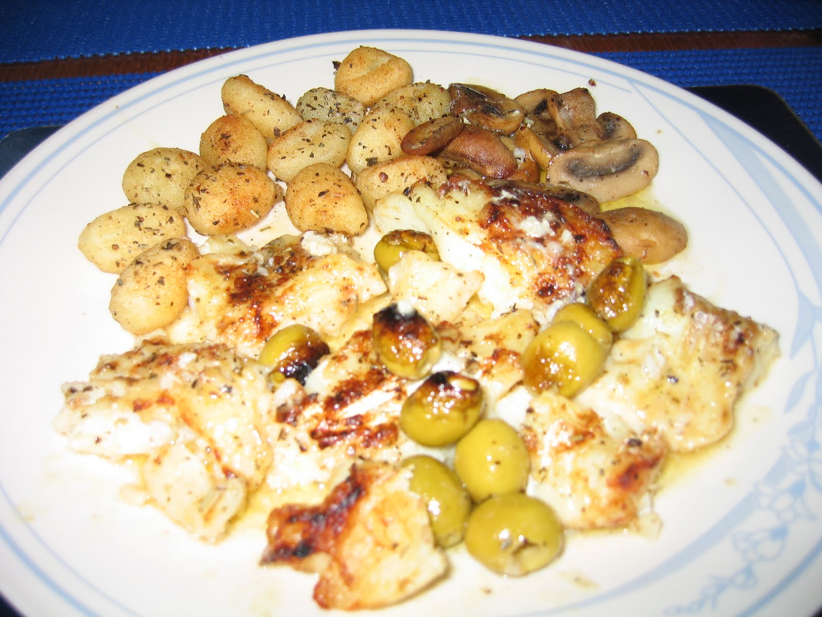
During the day we re-stocked the fridge as there are good supermarkets in Svolvaer as it is the “capital” of Lofoten and we are not sure how well stocked other shops will be on our journey south.  I was able to buy some whale which I was told to grill for just a minute or two on each side and it was just like eating fillet steak very tender and I did not think it had a strong flavour, James opted not to have whale as he remembers eating it on his last visit to Lofoten, when he had it stewed and thought it had an after taste of liver which he hates.  I can’t say I noticed this.

I also had a bit of luck – there was a large British yacht (Trilogy) in the harbour who were doing a lot washing as they had a change of guests, so they had purchased the NOK 60 card to allow them access to the washing machine and drier and had been tipped off that they should leave the door to the laundry room ajar otherwise you are charged each time you open the door, when they had finished their laundry in the late afternoon they passed me the card so I could use the machines, they already had a Norge doing a load, so we now have clean bed linen, towels and clothes, 4 loads of washing!  I did not get it all dry until 1am! 

In the evening we spent nearly an hour viewing some ice sculptures at ‘Magic Ice’ between the visits of the Hurtigruten coastal voyage ships which each spend about an hour in port, so their passengers disembark and as ‘Magic Ice’ is next door to the quay they obviously get a lot of custom from the ships.  The Ice Sculptures’ are very good, you have to wear waterproof lined ponchos for warmth, in fact I need two, and gloves.

Wednesday 15th June 2011 – Henningsvaer and supper out on Bon Adventure.

Before leaving Svolvaer James gave the boat a good wash, as a seagull had been breaking sea urchins on the deck which made a horrid mess!  We then motored the 3 miles to Kabelvag for a lunch time stop and walk to Vagan Church referred to as “Lofoten Cathedral”, as it can accommodate up to 1200 people.  As is becoming the norm here, the church was not open but we were able to walk around the outside.  We then had drinks and dessert at the café on whose pontoon we had tied up at.
Vagan Church (Lofoten Cathedral) at Kabelvag

Bon Adventure arriving at Henningsvaer

Guest Harbour at Henningsvaer
We then continued on to Henningsvaer, dubbed the “Venice of Lofoten” as it is built around a number of inlets.  It is a very pretty fishing village, with racks of cod drying and lorry loads leaving the village presumably for Spain or Italy where it is very popular.  Because of its excellent quality, “Stockfish from Lofoten” is a geographically protected name in Norway, in the same league as champagne and Parma ham.  Cod is caught from February to April, the head and the body are dried separately, before they are hung out to air dry on the fish racks, the innards are removed, the liver is used in the manufacture of cod-liver oil and the roes are used in Norwegian caviar.  Whilst the dried Stockfish goes to southern Europe the heads are exported to West Africa for use in stews etc.  We bought a small packet of dried fish to try and I am afraid did not like it.   

We had had an email from Bon Adventure, a yacht we had met briefly in Bergen, to say they would be in Henningsvaer for Wednesday night hence our decision to meet them there.  Paul and Liz Jackson arrived with their crew of 3 and came aboard Paddington for Pimms before we were invited to join them for supper of ‘cold fish’ which they had caught that day, Liz cooked them in the oven ‘a la Provencal’ which was delicious.  I volunteered a pudding, so with a quick look at my store cupboard I came up with a cherry and nectarine trifle which went down a treat.  It was a very convivial evening and amazingly not just our two English boats arrived in Henningsvaer but another two as well.  We really are seeing a lot more English yachts here in Norway than we ever met in the eastern Baltic, but I suppose for the Scottish boats this is their back yard, rather like Holland is for the East Anglian sailor.

At 10pm the harbourmaster collecting the mooring fees arrived and tried to charge NOK 210 which includes electricity, however, the notice said NOK 200, so a Norge on board Bon Adventure remonstrated with the man, so we all got to pay last years rate, as the notice board had not been updated.  It also says to pay at a parking meter which is not there but we had been told by a local fisherman that the harbourmaster would come round to collect our dues.  The last English boat arrived after 10 pm so they escaped the mooring fee!  However, had there been an honesty box they would have used it.