PADDINGTON IV in a Dutch Canal in 2009

PADDINGTON IV in a Dutch Canal in 2009

Monday 30 May 2011

Bronnoysund - Bodo via the Svartisen Glacier


Thursday 26th May 2011 – OUR AMAZING DAY – Crossing the Arctic Circle & Svartisen Glacier

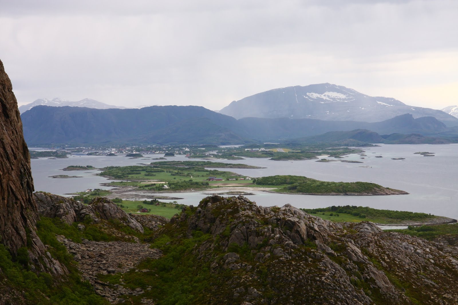
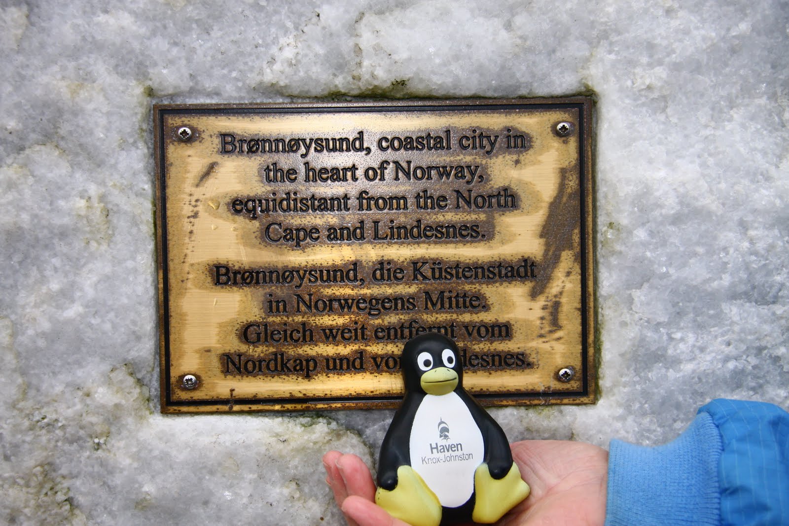
We left Bronnoysund, which is the mid-point on the Norwegian Coast, at 7 am having filled up with Diesel.  78 nautical miles later at 17.45 we passed the Arctic Circle Monument and a further 3 miles on at 18.03 we crossed the current Arctic Circle at 66N33.44, as given by Google the position of the actual Arctic Circle changes each year with the tilt of the world axis.

Arctic Circle Monument

Crossing the current Arctic Circle

We continued on for a further 27 n.miles to the Svartisen Glacier.  We could see the top of Glacier for many miles as we came up the coast.  The name means black (svart) ice (isen).  

An early view of the Glacier
The Svartisen Glacier is the second largest in Europe covering 370 sq. kilometres, the first largest is Jostedal which is also in Norway.  We chose to visit the Glacier from the Holandsfjord to a part of the Glacier called Engabreen, which has a sub-glacial laboratory beneath it, researching the charges to the Glacier and microbes that live in the environment, all of which is being used by scientists in planetary research of what might be found on places like Mars.
 As we turned the corner of the Holandsfjord and got the first view of the Engabreen finger of the fjord coming down it was a real ‘wow’ moment.  We berthed on the Engen pontoon beneath the Glacier or so it seemed as the woods between us and the Glacier hid the lake in front of the Glacier and it really felt as though you could nearly reach up and touch it.  The first thing we noticed about the pontoon was that it had no walkway off and was just attached by ropes to the bridgehead and a buoy at the other end.  We later learnt that it had broken during the winter and has gone off to be repaired, however, a dinghy has been carefully left (no oars) for visitors to use, soon after our arrival at 10 pm, we watched some crew from a Polish boat that was already on the pontoon pull themselves back from the land using ropes that they had provided, it looked very tippy.  


They had just returned from climbing the rocks to the Glacier.  By 4am when I awoke and took some wonderful photos of the reflections around the Fjord the Polish boat had already left.

Distance motored / sailed: 122 nm


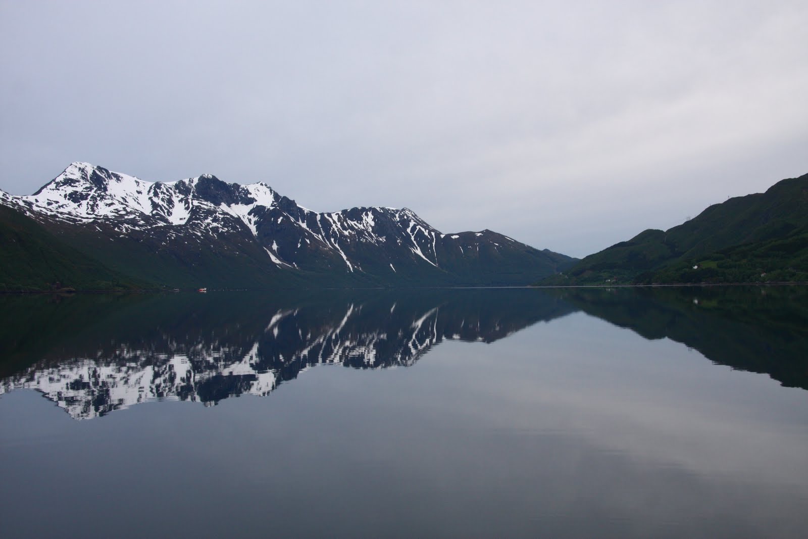
4 am reflections from around the fjord


Friday 27th May 2011 – Our first attempt to reach the head of the Glacier

After a leisurely morning and a cooked brunch we pumped up our red Avon dinghy ‘Marmalade’ and rowed ourselves to the shore – much more stable than the fibreglass dinghy provided.  We walked the mile to the café in front of the lake before the Glacier and on speaking to ‘Madam’ who said both routes to the Glacier were easy but her personal favourite way was through the woods on the right hand side of the lake, which I had already read was the prettiest route, so that decided us to go that way, it was definitely interesting there was a swing bridge across the swirling river (leaving the lake for the Fjord) which I did not enjoy and then we followed various unmarked paths, not knowing whether they were made by man or beast and had to ford a number of streams leading to the lake.  
  

Swing bridge
 
Crossing a stream
Ravine

We then came out near the beach in front of the ravine down from the Glacier, after that it was a climb up rocks with only cairns people had placed to give us any idea of where to go, it was a long way up over streams from the mountainsides, James was becoming more unhappy with the height and incline of the rocks, I was keen to keep going and he managed to follow me until after crossing one steep water course we were faced with an old rope attached to rusty rings at each end which I gave a pull but at that point I also felt enough was enough as the rock was very smooth with few foot or hand holds and although we were really very close the end of the Glacier our nerve failed us.  Getting back down was not that easy – had to slide on our backsides at times and then the walk back through the woods proved difficult and we had to retrace our steps a few times when we reached an area of streams that we could not ford.  Eventually, we got back to the swing bridge and the café where Madam although not really open was happy to have our money and provided us with coffee and cake.  
Cafe by the lake in font of the Glacier

Some of the streams we had to ford!
The whole walk was 6.3 miles and we were disappointed not to have reached the ice of the Glacier.  On returning to the boat we stopped for a chat to the man who runs a little ferry service and he said the route on the left hand side of the lake going up the road was easier.

Saturday 28th May 2011 – Carol reaches the Svartisen Glacier
The end of the Glacier lived up to it's name of black ice, very dirty, other parts vivid blue.
 This morning after brunch we decided to get the bikes out, to cycle the road past Engen Lake.  As the tide was in James was able to put the folded bikes in their bags into the dinghy and just push off from the pontoon across the 6’ to the bridgehead and manhandle the bikes on to the landing stage.  We again rowed to the shore and walked back down the landing stage to collect the bikes and assemble them, the bags were left in the dinghy.

We cycled the 2.2 miles to the end of the road nearest the Glacier and then walked / scrambled our way up the hillside, to begin with the route had a chain handrail to follow, when that ended we carried on following white painted markings on the rocks at the point these ended quite near the ravine taking the Glacier melt water down to the lake, James was again feeling uncomfortable by the height, so I left him sitting on a rock.   
James on his rock
Ravine taken from below the Glacier

I continued on following various cairns and made it to the Glacier and was able to collect ice for our evening drinks.  Soon after I arrived 6 other people made it up to the Glacier so I was able to get someone to take my photo by the Glacier and they confirmed seeing James sitting on his rock.  Whilst standing down by the Glacier pieces of ice where plopping down beside me!  
A blue ice cave taken at the Glacier

The worse part of the climb came on the return journey when I had to make my way back down a shallow 6’ ledge with few hand holds and not being able to see where to put my feet, I nearly froze but there were others behind me wanting to get back, which was just as well as they helped me find the route back, having followed one false trail, James was still sitting waiting for me cross, with himself for being beaten by his fear of heights for not reaching the Glacier.  It was interesting to see the few flowers that grow on the mountainside, were ones that I associate with rock gardens e.g. London’s Pride also there were a lot of tiny yellow mountain pansies, more like violas in size, but my wild flower book identifies them as mountain pansies.


On the way down we watched a bus load of youngsters being dropped at the end of the road who along with some local guides proceeded to climb the mountain but we were interested to see that they took a completely different route far to the left following some red arrows and more rope hand rails which we had not noticed before.  On talking to one girl and then to some of the adult teachers, we heard that this activity was part of a week long get together of children from Norway, France, Belgium, Poland, Czechoslovakia and Bulgaria, whose whole trip had been funded by the EU and this was the second year of the project, now I know where some of our EU money goes!  We knew that a few of the youngster were going to have a chance to walk on the glacier, when they would have to wear crampons and have ice picks and be roped together.  So we watched through binoculars the way the children were taken in case it looked any easier, in the end it looked a lot further and they had go via a hut where the local guides obviously store their equipment and this was still a long way from the edge of the Glacier, eventually after at least 4 hours we saw some of them getting on the ice, strung out like ants even through the binoculars and with the naked eye you could really only make them out when they were grouped together.  We felt rather sorry for the children who had to wait around for those doing the glacier walk as I don’t think the majority even got to touch the ice unless they were prepared to walk quite along way – I only noticed 2 do this.
On our way back down

In front of the cafe looking up to the Glacier
Before returning to the boat we cycled as far round the fjord as we could before coming to a gate and a steep track down hill, which we decided we would not wish to walk up.  However, I had two bits of luck firstly I found a NOK 200 note lying on the track (worth about £25) and then I found wild rhubarb to pick – I had read that it could be found wild on the Islands but this was the first lot I had seen, so I am now enjoying stewed rhubarb which is one of my favourites and James’ hates!

By the time we got back to the boat the tide was along way out, so we decided that we would not risk dropping the bikes over the side of the landing stage into the dinghy so a better option was to take the bikes and the dinghy to the beach which was now exposed and fold the bikes up there and row them back to the pontoon which is what James did and then he came back for me by the rocks closest to the pontoon.

Bike in its bag back to dinghy
Bikes back to boat
That evening we enjoyed Pimms with glacier ice and a young couple (German man and New Zealand girl) arrived in their yacht we gave them a Pimms before they set off to walk to the Glacier at 9 pm back just before midnight, with the constant light you can do these things and the ice on the glacier turned pink in the twilight which is all you get here at the moment.

Sunday 29th May 2011– Bodo

Just before leaving the Svartisen Glacier after breakfast I was in the heads when my back suddenly became agony – I really can’t pin point what I had done differently but suffice it to say I have been in agony ever since.  I was little help to James on the motor round to Bodo (he did have the mainsail up for much of the way, but I don’t think it was doing a lot) and I spent the afternoon in bed with the electric blanket on.  We arrived in the rain and I was only able to give limited help with mooring the boat, it preceded to rain all night.  I think I shall have to find an Osteopath.

The cost of the berth is NOK 150 p.n. which is payable with a credit card at a parking style meter on the shore along with the electricity at NOK 1.75 per kilowatt so far 2 kilowatts have given us 19 hours of power, running the greenhouse type heater all night along with my electric blanket and the immersion heater for 7 hours.  We have also got free internet access from Bodo Guest Harbour which is useful.
Distance motor sailed: 59 nm.   We have now travelled over 1500 nm.

Monday 30th May 2011

A day of doing very little other than a visit to the Tourist Office, who gave me the name of a nearby Osteopath who saw me at 15.30 and has manipulated my back and says it is now aligned correctly, still sore but I think I am moving a bit better - time will tell.  Not much seems to be open here yet - the season does not start for another 3 weeks and today with my back the last thing I want to do is sightseeing, also the weather is very variable - sunshine and heavy showers.  Hopefully, tomorrow I will feel up to taking a load of washing to the machines in the Harbour Office.

Hurtigruten Ferry making a tight turn out of Bodo!
     
An old boat in Bodo

Paddington IV in Bodo


Tuesday 31st May 2011


My back is still painful, but I think a little easier.  I managed to do two loads of washing, once again payment is via credit card NOK 50 each per wash and dry, having paid for two washing machines I now realize that I could have got two loads done of 40 degree washes in one machine as you get the machine for 100 minutes, the driers last for 120 minutes but having given the first load 60 minutes and it was still not dry, I then used the second drier to get my second wash dry.  Therefore, to get two loads washed and dried costs about £25!  This is really a note for anyone else visiting Bodo!  Additionally, if you wish to use the showers you also pay at the same credit card terminal!

Later in the afternoon I found the post office for stamps so at least I know I have the correct amount to put on   postcards and then I did a fresh food shop as I suspect the shops in the Lofoten's will be expensive with limited choice.

Amazingly the 2 kilowatts of electricity that we paid for on our first night (NOK 3.50) is still going strong - I now have a theory that as long as you pay for some electricity is does not really calculate what you are using - I expect most people usually opt to pay for a lot more kilowatts than we did; if that's not the case then the other marinas which charge anything from NOK 50 - 100 per day are thieves!  


Wednesday 25 May 2011

Torghatten - the mountain with a hole through it!

Sunday 22nd May 2011

We made an early start from Kristiansund, fuelling up at a 24 hour self-service pump close to the Guest Marina.  The early part of the day was calm with rain but later it cleared and we had a good sail.


An interesting looking lighthouse.
   
It was one of those days for pushing on, we past the spot James had earmarked to stop in the mid-afternoon, on these occasions we start at about 5 pm to look at our route to decide how far we might go in the next 2 – 3 hours, then we turned to the harbours book to try and find something suitable on our way, on this occasion it came up with the almost enclosed harbour of Kuringvagen at Stokksund, which has a Kro (Inn) overlooking it.
The Kro (Inn)
We tied up at 20.30 some 13.5 hours after leaving Kristiansund, so we sat down to a quick supper, then I took a walk around the place, there was a fisherman’s hut with fish strung up to air dry all around it, then up on the hill I could see down to a supermarket and ferry terminal.  The club house showers and loos were open but although I tried 2 doors to the club house I failed to try the third which lets one in to collect an envelope to put the berthing fee of 125 kr into an honesty box, however, the other English boat already berthed there told me where to go.  We seem to be seeing far more English boats than we ever did on our Baltic trips of 2008 & 2009.  We have seen one Northern Irish boat twice so far but the others have all been different and I think at nearly half of the places we have visited we have come across another English boat. 

Yesterday, I heard that my father had had a minor heart attack on 17th, but after a day in hospital had discharged himself before they could do an angiogram, so I was pleased to speak to my sister who had been to visit at the weekend as to hear how she had found him and my mother, who has high blood pressure.  James had suggested that I fly back from Bodo next week for a few days but for the present, I am being told that is not necessary.
Distance motored / sailed: 83 nm

Monday 23rd May 2011

Twelve hours after tying up we were on the move again, it was another mixed day of motoring and sailing, at times it was sunny enough to sit out in the cockpit with jackets on, not something we have done much of yet!  As the day wore on we knew we would not make Torghatten - the Island with a hole in it, so stopped short of it by 12 miles and went into the south harbour of Vennesund, whose main claim to fame is as a busy ferry route on highway 17, we watched a fair being transported in two goes.  There was one floating pontoon with finger berths for small fishing boats and a hammerhead with no mooring rings or cleats which we had to use, just before the roadway.  Luckily we were blowing on so James had time to lie flat on the pontoon and pass our warps around the joints to the floats and our springs around each end of the hammerhead.


After supper I had a walk around to the ferry docking area and campsite, I got some good photos of the reflections in the water.  On the other side of the road was the north harbour also with a short pontoon for small boats.


10 pm - Reflections of Vennesund  
Distance motored / sailed: 98 nm

Tuesday 24th May 2011

We awoke to the sound of wind and we were now being blown hard on to the pontoon, having checked the weather forecast on the internet we decided to leave and with lots of fenders at the bow James managed to reverse out of the berth.  Once back to sea we were pleasantly surprised to find the sea not as rolly as the day before and we had a good sail to Torghatten, where we did the tourist bit of taking the boat to the spot at sea where you can view the hole through the mountain. 

“According to Norse legend there was once a giant troll called Hestmannen (‘the horse man’) who became besotted with a beautiful ogress, Lekamoya, when he glimpsed her bathing in the sea with her 6 sisters.  He decide to steal her away at midnight (night is the time when trolls come out).  As he galloped southwards, the seven sisters saw him and fled as far as Alstahaug, where they flung themselves exhausted to the ground.  When Lekamoya fled on, Hestermannen raised his bow to shoot her: if he could not have her, then no-one else should.  The King of the mountains, Lekamoya’s guardian, deflected the arrow with his hat.  Dawn broke, the rising sun turning the trolls into the mountains of Hestmannen near Melfjord and the seven sisters into the Syv Sostre range on the island of Alsten (seven small mountains).  The king’s hat became Torghatten – the mountain with the giant hole!”

Torghatten, mountain with a hole
After viewing the hole from the sea we decided to tied up at Moyhamma, another small yacht club with a single pontoon, where we were able leave the boat and walk to the Mountain and then follow the route 160 meters up to the hole which is also 160 meters long, 35 meters tall by 15 – 20 meters wide.  It was certainly spectacular, the size of a small cathedral.  James did not feel able to cope with the walk down wooden steps to the bottom and then up a bit again for the view out to sea over islands from which we had first viewed the hole but I did it and felt it was worth the effort.  We both felt a great sense of achievement.  The GPS showed that we had walked a little over 5 miles but it did not take into account the steps need to get up the Mountain to the hole which is a 100 meters from the top of the mountain.  

Proof we made it to the top!

View from other end of the hole!
View looking down the way we walked up the mountain, I am just visible amongst the rocks.

On this walk as with others the woods were full of Wood Anemones and the marshy areas with Kingcups and up the mountain were a lot of violets.  In one spot I saw a number of purple orchids but the overriding flower here is the dandelion, every where we go there are fields of it, verges and gardens are full of it, so I have decided it should be the National Flower of Norway!
Moyhamma

By the time we got back from our walk the forecast gale was approaching, so as Moyhamma was very sheltered and we were blowing off we decided to stay put.  Electricity and water are both included in the 100 kr fee for the night, once again put into an honesty box – not another soul was seen.
Distance motored / sailed: 18 nm

Wednesday 25th May 2011

Once again we awoke to the noise of a howling wind and rain pattering down, so it was a slow morning, but in the end the wind seemed to be calming down, so we opted to leave and try and make some inroads into the 100 miles to the Arctic Circle and Svartisen Glacier that James wants to make our first target.  However, after just 12 nm of good sailing the wind increased to force 6 with gusts of 7 in rather exposed sailing fairways, so James decided to turn back to Bronnoysund, which is Norway’s geographical midpoint on the coast.  We took the opportunity of having a Coop Mega opposite the guest harbour to replenish fresh food supplies.  It has rained on and off for most of the afternoon and evening.  The Swedes we met in Kristiansund turned up this evening and the harbour master came to check if we needed keys to the shower block.  The berthing charge is 100 kr plus 50 kr for electricity, into an honesty box.  We found the fair that we saw on the move from the ferry at Vennesund is setting up here, opening tomorrow for the weekend!  Hopefully, the wind will have dropped tomorrow so that we can make an early start heading for the Arctic Circle.
Distance motored / sailed: 14 nm


Tuesday 24 May 2011

Kristiansund

Tuesday 17th May 2011 – Norwegian National (Independence) Day, a holiday.


The plan today had been for a half day trip, from Hareid to Bud, a marina used as a jumping off point for the trip around the Hustadvika headland another well document difficult passage.  In fact the lifeboat offers an escort service to take boats around this headland.  We had thought that we might be able to watch some of the celebrations of ‘National Day’, whether Bud was big enough to host marching parades we will never know, because as we approached we decided that as the weather was calm, just a bit of a swell on the sea and we knew was forecast was to go bad in a couple of days, we might as well push on around the headland, also James was suffering from a bad cold and that day I thought I might be catching it, so neither of us was very interested in partying.   

We opted to take the outside route around Hustadvika, although we watched fishing boats and coasters taking the inshore route – I had had a go at plotting it but when I discovered it was fractionally longer to Kristiansund than James’ outside route and with a lot of very narrow passages with difficult navigation, I opted for the outside route staying about 5 miles off the headland.  Like the Stat headland before we were left wondering what all the fuss is about these headlands, but perhaps in bad weather it would be quite a different story, also we think that most of the Norwegians are used to only having to sail through inland waters sheltered behind mountains that the open sea perhaps is rather daunting.

We reached Kristiansund in the late afternoon and could hear the noise of celebrations from the main Island of Kirkelandet, which is also where the guest harbour is situated, a 10 minute stroll to the main street and 5 minutes from a Coop supermarket and bus station.  The Marina offers WC’s showers (10 kr) and an industrial washing and drying  machine, cost 30 kr per token purchased from the harbour master, who spoke little English but understood a lot and was a very amiable gentle old man (I suddenly think that sounds a little odd considering we are getting older or at least James is!  But he seemed older)
Our Harbour Master

On arrival we met some Swedes also going north for a second sailing season, so we invited them for evening drinks and James picked up some tips for the trip around the Lofotens.
Distance motored / sailed: 74 nm

Wednesday 18th – Saturday 21st May 2011

It was really nice to stop rushing and have a break, James was in need of medication for his cold which had gone on to his chest and this was provided by the Pharmacist at the local chemist.  The first morning we spent sorting the boat out, I did two loads of washing and James cleaned the boat and dried bilges etc.  In the afternoon we visited the tourist office where we found the most helpful staff of any where so far.  We also managed to get our data card topped up and where very glad that the shop did it for us as it took them a few goes and they understand the language!
   

View from a bridge towards Kirlelandet, the largest of the Kristiansund Islands


On Thursday we had an email to say the new bow thrusters unit ordered by the chandler in Bergen had been delivered to a local chandlery to await our collection.  James tried to offer a credit card to pay for it, but they would not accept it and just said pay for it when you are next in Bergen, even though James had told them it will not be for at least two months, it is so trusting of them and I worry that we’ll hit a ice berg and not get back.
Anyway, the chandler was on another of the four islands that makes up Kristiansund so it was a good excuse to use the Sunbaten ferry which claims to be ‘The world’s oldest public transport company in uninterrupted operation’ which has been operating since 1876.  The round trip takes 20 minutes and they go every half hour during their operating schedule.  The cost is 26 kr per trip or a day pass is 50 kr, so that is what we purchased and our bikes were carried for free.


'Angvik' the newest Sunbaten Ferry
We collected the bow thrusters control panel only to discover it was the new model which we had seen in Bergen.  However, it fits and works and is one of the few things on this trip which is cheaper than in England having been made here.  We then had a cycle up and down Innlandet which is the smallest of the islands before catching the ferry to Nordlanet where we walked around the Church but it was not open (the season has not begun) and had cycled around some of the Island.  By the ferry landing stage we had watched a very busy fishmonger whilst we waited for a rain shower to pass and on the way back it was equally as busy, so I went in and we tried out their fish hamburgers (very good), fish cakes and fish balls which I would describe as fish dumplings and had to be boiled for 15 minutes, I would not bother with them again.
  
We had another English yacht alongside us whose skipper had just had a family bereavement so he and his crew (2 of them had only arrived two days before) were all having to fly back to the UK on the Friday, so we benefited from all their perishable stocks – just like Christmas, and I was left to explain to the Harbour Master why he had another unpaid for English boat in his marina, which might be there for a few weeks, he was very laid back about it!  On the Thursday evening we had the owner & crew over for Pimms / wine, payment I felt for the goodies I was hoping to gain!  Anyway, it was a very convivial evening.  I was able to make potato & leek soup from their left overs, I carry on board a small pressure cooker and a hand blender with all its attachments (whisk & small food processor) which is very useful for making soups and in this cold northern climate a very good lunch whilst on the move served with some long life rolls.  I also brought with me 2 truckles of cheddar cheese, which were an expensive luxury – I will admit that when I ordered them from a local butcher with a reputation for an excellent cheese counter, I had no idea how expensive they would be and anyway he did not know if he would be able to get them as it was outside the Christmas season, so I never asked for a price, however, they don’t need refrigerating as they are well wrapped in cheese cloth, so I only have to keep them in a bilge which is nearly as cold as the fridge, as the water temperature is only about 10 degrees.  As yet I have not checked the price of cheese here, otherwise I might cry!  But it does mean we are fairly self-sufficient here other than for yogurt, fruit & salad, veg I have in tins or the freezer.

Friday was a fairly restful day, we did manage an afternoon walk up to a viewing point above our Island of Kirkelandet and alongside their old reservoir system and then out for a view over the way we had approached Kristiansund.
                                                         Statue seen at a lake on our walk
Views of our approach to Kristiansund, as seen on our walk.


Bike problems: during the winter my bike had been in for a professional service and had a new rear wheel, tyre and brakes fitted so I expected to have trouble free cycling at least for a while and certainly the 15 mile I did in Holland seemed fine.  However, when James got the bikes out in Kristiansund he was worried that one of the rear brakes was rubbing on the tyre so he took it off and filed in down and cursed putting it back.  Then on our first ride I had complained that the rear tyre felt difficult to turn, so James promised to look at it before our planned long ride to the Atlantic Road on Saturday.  On Friday evening he had a look and said the opposite brake to the one he had work on had worn the tyre down to the metal threads, we have on board a tyre which states it is the right size although it clearly looks too big, however, James decided to try and put it on and of course it would not fit, so then he had to replace the old tyre and said it would get me to a bike repair shop.  The old harbour master marked on the map the spot on another island where there was a bicycle shop.  The next morning my tyre was flat, this meant that I had to push my bike to catch the first ferry of the morning – 09.30 on a Saturday and then up the hill on Nordlandet Island to the bike shop, who said come back at 11 am.  So we continued walking up the hill and found a big out of town shopping mall, where we could get a coffee.  Soon after 11 am the bike was ready and as luck would have it the ferry was on its way back in as we arrived at the docking area. 


We had time to go back to the boat to collect our things and return to the bus station for the 12.30 bus, which would take us across to the Island of Averoya through the 5 km tunnel.  The driver said he would drop us at the nearest point to the Atlantic Road; unfortunately this bus did not actually go the Atlantic Road whereas the next one did.  Anyway, due to a lack of Norwegian and knowledge of place names, we thought it would be fine, as the tourist office girl had marked a circular route which she said was about 20 miles, first mistake was not to know that a Norwegian mile is equal to 10 English miles!  Second mistake was the town we were dropped at was 2 Norwegian miles from the Atlantic Road up and down many hills.  However, luck was on our side, as we pushed the bikes up the first hill out of the town (our bikes have Union Jacks stuck front and back) a man mowing his lawn saw me and asked where we were going and when I said to the Atlantic Road, he look aghast and said it was miles, he then insisted on putting the bikes in his van and driving us the 13 miles to the other end of the Atlantic Road so we could cycle it back.  All we know of this savour is his name Dag and that he had been in London in early May and has been an Ipswich Town football supporter for 40 years when he saw them play with George Burley in Norway as a youth and got all their signatures.  Dag refused any money for his fuel so I gave him our card with email addresses and told him to contact us if he was ever in UK again and that we would then try and get him Ipswich Town tickets. 
Dag – My Hero view from the Atlantic Road

The Atlantic Road is a stretch on the highway 64, the road is 8,274 metres long and goes from Vevang in Eide to Karvag in Averory.  It was opened in 1989 replacing a ferry route and includes eight bridges, one of which: Storseisundet bridge raises itself up above the flat islands to give room for the shipping lane to pass under towards Averoy and Eide.  Steep on each side, it turns in towards the next island, majestically.  Hulvagen Bridges creep up across the ocean linking various small islands.  Here the incoming waves break when the storms are at their height, but this is also where the leisure anglers gather when conditions are good – this part of the road can present unusual traffic hazards when a cod lands on your windscreen and the angler backs out into the road to secure his catch!

The above is taken from a description in a tourist brochure.  The Atlantic Road has now become Norway’s eighth most visited nature-based tourist attraction and was named as the worlds best road trip  Dag told us that it has been used in many car companies advertisements and also Fifth Gear did a programme featuring it.
Carol cycling up the Storseisundet Bridge

We enjoyed the cycle ride back to Karvag – only 5 miles and then waited nearly two hours for a bus and the last of the day, but it did mean we could get lunch at a nearby filling station while we waited.  Had we known better we could have left Kristiansund on the 13.15 bus and been dropped at Karvag or on the other side of the Atlantic Road to just cycle one way as we did in the end; without Dag I don’t think we would have made it at all.  We were pleased to see when the bus passed Dag’s summer home that he had got his lawns mown before the rain came, so he won’t be in trouble with his wife!  Dag works in the fish processing industry and it was interesting to hear how profitable it is for the Norwegian economy.  He said all the fish farms that we see around almost every corner of the Fjords as we sail them are very profitable and the fish virtually all go for export.

We enjoyed our stay in Kristiansund and it was lovely to have a break from all the rushing.  However, we shall be back into rush mode to get to Bodo for the end of May, just under 400 miles to go.

James enjoyed some of these!   

Arrangement of local flora

I like to have flowers on the boat, but they are very expensive here, so I have been picking the local flora to enjoy on board.