PADDINGTON IV in a Dutch Canal in 2009

PADDINGTON IV in a Dutch Canal in 2009

Tuesday, 14 June 2011

Tromso Day Out

Thursday 9th June 2011 – Another Red Letter Day – TROMSO DAY OUT

This was a day out that nearly did not happen, due to the cost of the Express Ferry.  On
our way to Harstad I had telephoned the tourist board for information, one of which was
the cost of the Express ferry to Tromso and was told about NOK 450 p.p. single.  Then on Wednesday we went to the bus station where we thought we had to book the tickets for the ferry to get times and prices and were told that there was a 20% discount for a return ticket, this still put the cost each at NOK 675 and as we are only getting a little over NOK 8 to the £1, James still felt it was too much to spend particularly after our trip to Sweden on Sunday.  In the end I offered to give the trip to Tromso to him as an early anniversary present.  When I went back to buy the tickets I found that they are purchased on board.
Our Express Ferry


So it was that we were up early and on the ferry for the 07.00 departure time.  On boarding the ferry we had to give our names and ages and where we were going, at the same time James handed the officer one of our ‘visiting cards’ and asked if we could visit the bridge during the 3 hour trip.  I had a pleasant surprise when I bought our return ticket as it was quite a lot less than I was expecting: NOK 880 for the pair of us.  In fact I even had to check it was a return ticket!  Soon after leaving Harstad we were ushered up to the bridge where we spent a long time talking to the officers who were charming and very welcoming, we even got to sit in the captain’s seat and were able to be on the bridge to watch the docking at both Finnsnes and Tromso.
Carol in the Captain's seat


Once in Tromso we went straight to the tourist office to collect maps and information on what to see during our day.  The first thing we did was to visit Tromsdalen Church, more usually referred to as ‘The Arctic Cathedral’, which is the most popular attraction in Tromso and the place James had wanted to see.  The Church stands on the opposite side of the main Tromso Island with a long bridge which seems to lead right to it.  The unique architecture was inspired by Arctic Nature.  There is an amazing glass mosaic entitled ‘The Return of Christ’ which dominates the alter end and is one of the largest stain glass windows in Europe.  At the back end of the church are large picture windows looking across the water to Tromso city and the whole interior is beautifully light, it certainly lived up to all our expectations. 

Photos of the 'Arctic Cathedral, Tromso


View to the back of the church.


We then continued our walk to the cable car which is on the same side as the Arctic Cathedral.  The cable car took us 421m up Mount Storsteinen for a fabulous view over Tromso, we were so lucky with the weather as it had suddenly turned hot and sunny.  There were still patches of snow on the mountain top and we enjoyed our picnic lunch sitting on a rock. 
View of Tromso from the top of the cable car.

James in the snow on top of the mountain.

From the cable car we walked back across the bridge to Tromso city centre and went round the Polar Museum and then to Polaria which is an arctic-themed experience centre which show a wonderful film on five screens (only 4 working when we were there) on “Spits Bergen (Svalbard) – Arctic Wilderness”, we watched this twice.  There are also aquariums of fish and bearded seals.  At the end of the day we asked if we could see a film on Antarctica, which is shown in the winter and on special request in the summer, which they put on for us and about 4 others, once again it                                                                                      was spellbinding the photography just fantastic.
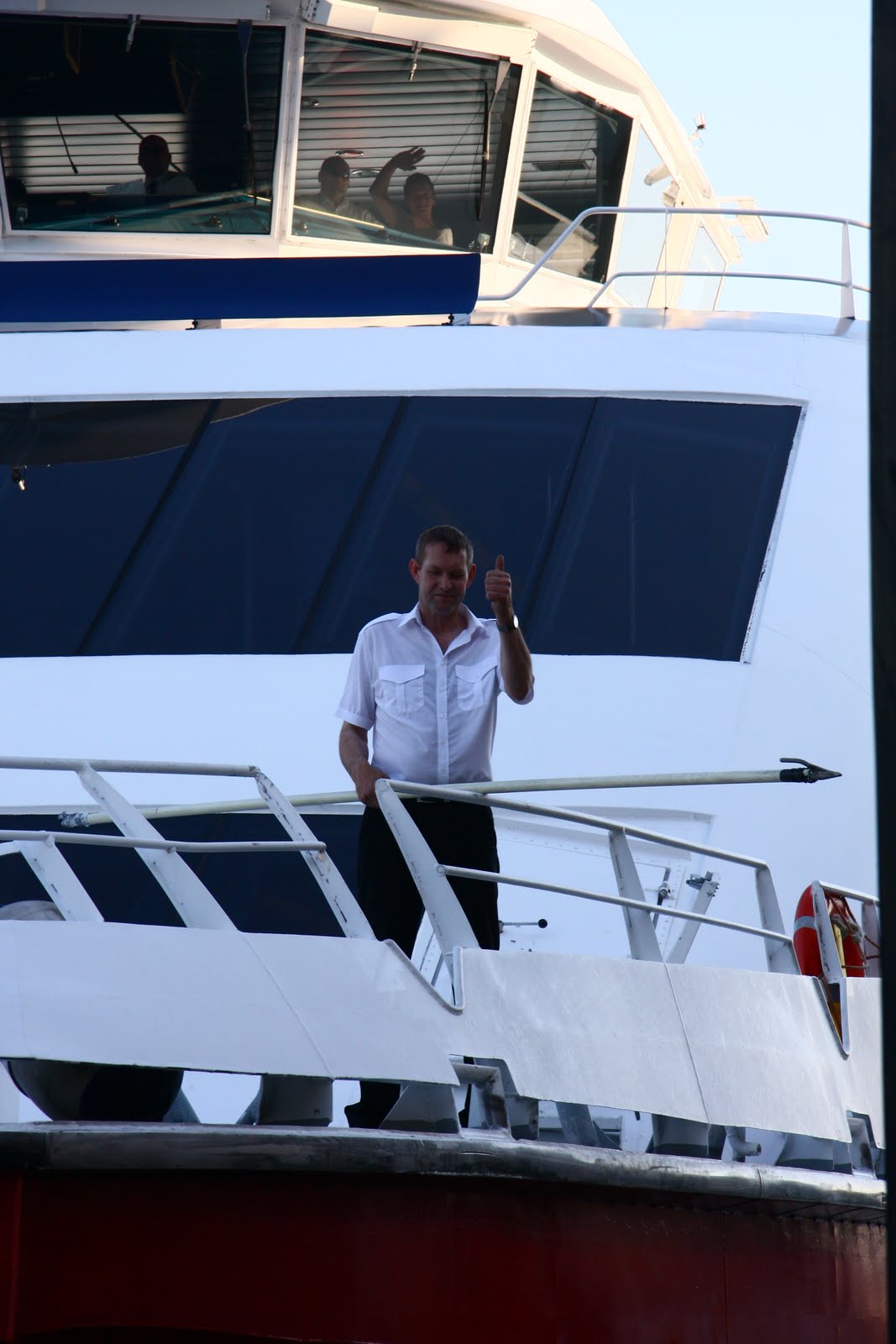
The Crew of the ferry waving when they spotted us!

It was then time to make our way back to the ferry for the 19.30 return trip, we got a super welcome back on board by the crew and James was thrilled on departure to be allowed to push the throttle up to full speed (under instruction of course) and then the engineer took him round the engine room – talk about little boys with toys!  On return to Harstad we were again allowed on the bridge for the docking which gave us a good view of Paddington IV in a berth opposite the ferry terminal.  To cap a wonderful day the three officers (Captain, First Officer and Engineer) came back to our boat for tea (they were not allowed to drink as they had to be up early for the 7 am ferry the following morning).  The two youngest crew members: a lad who was the deck hand and ticket seller and a girl who runs the small cafe and cleans up between crossings were left to put the boat to bed!
It was certainly a splendid day out, made all the more special by the really warm welcome we got on the express ferry; we felt we were treated like royalty!

10pm arrival back in Harstad - Carol on the bridge deck, Paddington IV in the guest harbour behind me

Paddington dips ensign to the King

Tuesday 7th June 2011 - Paddington dips ensign to the King

We woke as expected to rain and I asked James if he had looked at the tourist information and pilot books that I had left out the night before, as once he had gone to bed I had continued to study maps and information on the region and thought it might be fun to go to Harstad, a place name that had cropped up in a book I had just finished by Henry Swain called ‘Return to Murmansk’ about taking his yacht to Murmansk in 1990 having been there 45 years earlier during the war, when he was an Able Seaman in a Royal Navy warship escorting a Russian convoy.  Harstad was further north than James had planned to go but there was a church famous for being the worlds most northerly stone church built during the middle ages.  I also saw an interesting navigational challenge up Ramsund which was virtually opposite the bay we were moored in and could see that we could approach the Raftsund and Trollfjord from the north.  Let’s just say a heated discussion took place and I was backing down to avoid a grumpy husband, when James agreed to go to Harstad.  [He did have to ring Haven Knox-Johnson our yacht insurers to check that it was OK to go further north than Narvik]

K. S. Norge, dressed all over, as first seen in the rain
K.S. Norge
 

The trip north through the Ramsund, did offer some narrow channels to navigate but the supposedly beautiful scenery was shrouded in low lying mist and rain clouds.  The Ramsund was a short cut to the Tjeldsund which we joined three quarters of the way up; here we had a strong tide against us so we opted to anchor for lunch in a small bay.  On the other side of the Tjeldsund we could see a large boat ‘dressed all over’ (for non sailors that means they had code flags – each letter of the alphabet and numbers have their own unique flag – strung from the bow [front end] to the stern [back end] of the ship) it also had an impressive ensign.  As we looked through binoculars we could see on the land behind coaches, marquees and lots of people milling around.  On leaving our anchorage when we thought the tide should have changed in our favour (of course it had not) we noticed a couple of splendid tenders going back and forth from the village to the ship and then saw the name “ K. S. Norge”.  We continued up the sound and kept seeing people waiting on the shore with Norwegian flags, at which point in dawned on us that we had probably just seen the Norwegian Royal Yacht with presumably the King on board.  On checking our AIS we could see the ship leaving and following behind us, so we stopped in a bay to let her pass and dipped our ensign.   We did feel sorry for the people he had visited as it rained all day as you can see from the photos – I heard later that the King refused a covered coach as he had promised to use an open topped one.   Anyway, it made for an exciting moment for us.  That night on the Internet I found on Wikpedia the following information of the K. S. Norge (I wonder whether K. S. stands for King Ship, Norge is the Norwegian name for Norway):

History:
When Prince Carl of Denmark, a naval officer, agreed to be elected to the vacant throne of Norway in 1905 (taking the royal name of Haakon), he was promised a Royal Yacht. Due to Norway's difficult economic situation after the dissolution of the union with Sweden, it never materialized.  During the two world wars the economy and other conditions never made it possible to acquire a yacht.
After World War II a nation-wide appeal was made for funds to purchase a yacht for the respected and aging king, who had become a truly national symbol through his steadfast resistance against Nazi Germany. Eventually, interest centered on the British motor yacht Philante built in 1937 by Camper and Nicholsons in Gosport, Hampshire for Sir Thomas Sopwith. One of the world's largest yachts of its time, the ship had been requisitioned by the Royal Navy in 1939 and used for Atlantic duty as the convoy escort vessel HMS Philante during the war.
 In July 1947, the ship was bought by Norway in time for a model to be made and presented to the King at his 75th birthday. After refitting was completed in 1948, King Haakon was finally able to take over his Royal Yacht, which was renamed Norge.
King Haakon used Norge extensively for travels in Norway and abroad.
King Olav took over Norge after his father's death in 1957. The King followed the traditions introduced by King Haakon, using Norge on both official and private occasions.  When King Olav died in 1991, Norge was taken over by King Harald.
The Royal Yacht Norge is owned by HM The King. A Royal Decree of 1947 provides that the ship shall be manned, operated and maintained by the nation's Defense Forces. In summer the complement of officers and crew is 54. The season begins when the King embarks in May and ends when he disembarks in late September.
The sailing schedule for the Royal Yacht varies from year to year. When the King is competing in major international yacht races, he uses Norge as a base. The King and Queen also make use of the Royal Yacht for official events in Norway and abroad.

Naval Vessels 'dressed all over'


On arrival in Harstad we were welcomed to the town by lots of Naval ships ‘dressed all over’, so we assumed that the King must have visited the town in the morning, we learnt later that was not the case.  The Navy was in town for the inter-naval sports championships.  We have learnt from watching the navy in action that during the summer their ensigns go out at 8am and are taken in at 9pm and this happened with quite a ceremony.  We opted to berth at the Town Harbour, with electricity but water was only on the pier head.  Payment is via an automated parking machine but whilst we were there both machines were out of bounds as the promenade was being replaced and no one came to collect our money.  
James said he saw a notice giving the charges as NOK 50 + 10 for electricity per day.
Motored: 38 nm

Wednesday 10th June 2011 – Harstad

The town is on the north-east corner of the Island of Hinnoya, the largest Norwegian Island, whose southern end is in the Lofotens, western side in the Vesteralen and Harstad comes under the South Troms.  It is also one of the meeting points at 08.00 for the Norwegian Coastal ferries – Hurtigruten which calls at 34 ports from Bergen in the south to Kirkenes in the far north, the round trip takes 11 days.
Trondenes Church from the sea

Our day began with a visit to the Tourist Office to collect a map and information on what to see.  Close to the town is the Trondenes peninsular, where the famous Trondenes Church which I mentioned before (the worlds northernmost stone church built circa 1250) is situated, unfortunately, it is not open for visitors until later in the summer. 

Church as seen from the Museum
However, we were able to walk around it and at the nearby Trondenes History Centre; we saw an excellent film on the church.  The other nearby attraction that was also not open was ‘The Adolf Gun’ – one of the world’s biggest land-based mounted guns built by the Germans in WWII.  We enjoyed the cycle ride to and from the peninsular and later in the day cycled to the opposite end of the town to see the other marina, which is very noisy as it is right by the main road to Narvik.  After which I went on to ‘Grottebadet’ a water park inside a mountain in the town centre.  It is not cheap at NOK 135 but it does offer: a 33 m pool with a selection of diving boards.  A therapy pool (extra hot) a fun pool with a flume, wave machine, Jacuzzi and other attractions, plus steam and sauna rooms.  I swam 50 lengths which is over a mile then tried out the therapy pool and steam room, before discovering a fitness instructor taking a water jogging class which I joined followed by water aerobics and a sauna.  Having gone it at 6.30 pm I left when it closed at 10 pm.  By the time I got back to the boat James was fast asleep and had sorted his own supper out.  I had some supper and prepared my rolls for the following days outing and then slept like a log!
The Swimming Pool, with fun pool behind the windows

Tuesday, 7 June 2011

Day trip to Swedish Lapland

Sunday 5th June 2011 – Day trip to Swedish Lapland on Europe's most northerly line.
Narvik Station - our Engine

As planned we caught the 09.20 train and the first of the day from Narvik Station to Sweden, we chose not  to get out immediately across the border at Riksgransen which takes about 45 minutes but to continue on to Kiruna, a journey of 2.5 hours.  The first part of the journey leaving Norway is all up hill, skirting the bottoms of mountains with some superb views.  We had been advised to sit on the left for the best views looking across valleys and down gorges.  Once in Sweden we began the slow journey down hill.
                                                                  Houses in the lake seen from the train

The first lakes we saw were still mostly frozen over, and then we came to a very long lake: Tornetrask where there were still small parts of frozen ice flows and snow around the edges of the lake.  This is the most northerly railway line in Europe and would never have been built if it was not for the iron ore deposits at Kiruna, needing a way of transporting it to the coast.


A still frozen lake seen from the train

River seen from the train
There were various stops on the way but the most popular was Abisko which seems to be a popular holiday destination for winter and summer with a ski lift and runs for winter sport and in the summer with fishermen and hikers – it is the beginning of the ‘Kings Trail’ (Kungsleden) which can be skied in winter and walked in summer.    The Kings Trail stretches for 105 kilometres and takes most people 7 – 10 days to cover, however, you can chose to do just part of it.  It is also the most popular hiking trail in Sweden.  There are mountain huts along the way along the way for people to stay in. this area is occasionally referred to as Europe’s last wilderness or Sweden’s own paradise – it includes Sweden’s tallest mountain Kebnekaise.

After the end of the lake came a period of Tundra, which if James’ memory from school geography is correct is frozen in winter and bogey in summer, certainly most of the vegetation is scraggly small birch trees which seem to dominate all the mountains areas we have seen in Norway and not firs as one might expect.  This was time for a doze!
Kiruna C Railway Station

On arrival at Kiruna we had two hours to spend before catching the last train back to Narvik.  Kiruna is a one horse town – everything is dominated by the LKAB mining operation, it is the world’s largest underground iron ore mine and whole districts are being moved – the oldest city district will disappear – buildings are being moved or demolished as the mine expands under the town.
Mining operations
However, we found the tourist board open which we thought good for a Sunday and collected some information and they have tables and chairs so ate our packed lunch there before walking to the Church which was voted Sweden’s favourite building in 2001.  It was built in 1912 and the altarpiece was painted by Prince Eugen.  The church was built to resemble a Lapp cot (or Sami hut) but I read that ‘is why it has a unique shape with light beaming in form above into an otherwise relatively dark interior’.  We were pleased to find the church open; they were preparing a stage for an evening concert.   
Kiruna Church
Bell Tower beside Church


Inside of Church and famous Altarpiece.
Had we been able to spend longer in Kiruna we could have taken a tour of the mine.  The sun came out for our return train trip and on arrival back in Narvik we saw mountains that we had not seen before because of the rain and very low lying mist that has dominated the last 48 hours.
View toward E10 bridge just before Narvik

View towards the Marina from the train as we returned to Narvik

Monday 6th June 2011
View of Yacht Club at 3am

Fueling pontoon at 3 am


We awoke to a beautiful sunny morning and not a breath of wind – what a change.  Although I had already decided I like Narvik the sun improved it even more.  The morning was spent using the yacht club shower and washing machine and in the sunshine all the washing dried on the boat – once again we looked like the proverbial ‘Chinese Laundry’.  James replaced his loo pump which was giving cause for concern, the pump which he bought in Bodo cost three times as much here than in the UK!  The boat also got a wash and polish.  After lunch we walked up to Narvik’s town centre to take photos in the sunshine and stock up on fresh fruit and vegetables.  As has been the case for most of this trip so far we are too early for various tourist sites to open including of this occasion the cable car to the top of a mountain which I should have like to have taken for the view. 
Sculpture in the centre of Narvik: seen in the rain on Saturday

Marina info: cost NOK 100 + 50 for electricity per night.  Shower and washing machine in the club house are free, code for the door is required and the key to the rubbish bins is also hanging in the club house.  Guest berths: 1 pontoon about 14 metres with water on the pontoon.  The pontoons leading to the guest pontoon are a bit rickety, take care not to trip and there is a bit of a long stride over on to the steps leading up.  There is a ICA supermarket about 10 minutes walk away up the hill (left then right out of the marina) and a Rimi in the Stors Senter (shopping mall) which is just past the turning to the station and tourist office.

We left Narvik at 4 pm – high tide hoping to gain some tidal advantage on the trip back down the fjord.  We  motored 22 miles down the Ofoten fjord and found a bay with mooring buoys, so we picked one of these up for the night.

Saturday, 4 June 2011

Pan Pan - Paddington IV responses to it

Saturday 4th June 2011

It has been a very wet day here in Narvik, so there was no hurry to get up.  However, at midday we braved the rain to walk up into town to so some shopping and to visit the Secord World War Museum which featured the battle of Narvik in the spring of 1940 and the fighting in the mountains before Norway capitulated.

We returned to the boat about 4pm to see that the fjord outside the marina was looking very rough and our boat was snatching at the mooring ropes so we had just completed putting rubber snubbers on our warps to help with the snatching when we noticed a yacht just outside the marina who looked to be in touble getting their genoa in.  We watched through binoculars and then passed the binoculars to a Norwegian on shore who was also watching anxiously.  I turned the VHF radio on to channel 16 and soon heard Bodo radio putting out a Pan Pan for a yacht (Barvaria 32 with 2 persons on board) in the Narvik area who had phoned in requesting help, they were asking for anyone in the area who could offer assistance.  I called up to James who by this time was on land with some Norwegians and he and one other came straight back to the boat, we left the Norwegian to speak to Bodo radio who asked if we could go out to assist the yacht.  So it was a rush around stowing things for the rough sea, getting the electricity cable in and warps; as we left the harbour, Bodo radio told us that someone else was also going to assist but would we go out and stand by should they need further help.  They were also speaking to a cargo boat who was at anchor outside Narvik to look for the yacht who had disappeared from our view into wind, obviously still trying to get their genoa in.  By the time we got out into the big seas, the wind had dropped a bit to a constant Force 6 and the sea was not looking quite so frightening.  Fairly soon we had Bodo radio calling us again to say that a rib had reached the yacht and was escorting it back into the marina, so that we could return and they thanked us for responding to their request.

Our Norwegian called up his 'troops' to be on the pontoon to help us berth, but actually once we were inside the marina we were very sheltered and berthing was easy.  It turned out that the boat in trouble was a local boat and I did wonder why when he must have known how sheltered the marina is that he did not just enter the marina with the stuck genoa still up and sort it out in here, even if turning space is a little tight.

However, the skipper of the boat we turned out to help came round very quickly to thank us, I think his wife was quite shook up, and soon after two policemen also came round to thank us.

We quickly had the boat back to rights and were pleased to enjoy our belated tea and cakes!  Tomorrow we plan to take the train to Sweden (the border is only 45 minutes away).


Friday, 3 June 2011

Bodo to Narvik

Reflections in Bodo
 Having reached Bodo as planned by the beginning of June (in fact we were early) we seem to be in a bit of a limbo as to how to proceed next.  All the way up here James had his routes planned and it was just a case of stopping at a suitable place for a night unless there was some particular sightseeing which we wanted to do.  Now we are here there does not seem to be a plan, as I keep saying it is all new to me and I am happy to see anywhere.  James has at least spent one week in 1998 sailing a Chay Blyth round the world yacht to and from Bodo to the Lofotens.


Wednesday 1st June 2011

The decision as to where to go next is being made more difficult by the forecast bad weather for the next week.  Having already had 3 nights in Bodo which has little to enchant one (other than being a good place to change crews with an airport on its doorstep, which is of no interest to us) except the fact that there is free Internet and our 2 Kilowatts of electricity seem to be going on for ever, we are frankly bored of the place.  The Tourist Office is particularly uninspiring and it seems most things do not open until the school holidays around 24th June, so trying to find places to go is proving difficult.  One place that sounded good was Kjerringoy, but at this time of year you cannot travel the 40km each way by bus in a day!  So the only answer was to sail there ourselves – it is in fact on our route north to Narvik which we have noticed seems to be missing the worse of the winds being up the end of a fjord and would then give us a definite plan to travel back south through the Lofotens for June. 

At last a plan was hatching so after much deliberation we left Bodo at noon for the 18 nautical miles trip round to Kjerringoy.  We started off sailing in the fresh south westerly breeze, only to have it slowly die and our speed getting slower and slower so as we wanted to visit the ‘Old Trading Post’ museum which closed at 5pm it was on with the engine.

Kjerringoy was a delight, a small marina in a delightful setting – mountains to be seen all around, many snow clad.  Good facilities including washing machine & drier (cheaper than Bodo) and a nice yachtsman’s living room with kitchenette and free weak internet access. 
Reflections in Kjerringoy


On arrival we rushed off to the ‘old merchant’s centre’ which was established in the late 1700s. 

I quote The business remained quite modest until a round 1820 when a boom began, led by good prices for fish.  The Kjerringoy merchants bought fish in Lofoten and elsewhere in Nordland, dried or salted it and  sold it in Bergen and other places.  Their boats returned with foodstuffs, fishing gear and other equipment, which they sold in their local store or in Lofoten.  The herring fishery experienced a peak from about 1860.  The merchant’s business was at the height of its prosperity around 1875, after which it slowly declined.’

We had about an hour and a half to look round before the centre closed, so we were sent straight to see the warehouse on the quay and the general store – now their sales shop selling appropriate gifts and souvenirs as it closed at 4pm.  At 4pm there was the last tour of the day around the merchant’s house overlooking the bay, although it was in Norwegian we got the gist of things either from the guide or the 4 others in the group. 
After the tour we returned to the new barn which houses the reception, café and lecture rooms where we were shown a film in English about ‘Anna Elisabeth of Kjerringoy’ who was the daughter of the first merchant, she inherited the business with her first husband and when he died she carried on running the business and eventually married her young clerk, 25 years her junior, which coincided with Kjerringoy’s heyday.  Anna Elisabeth died in 1879 after falling down her stairs having had a little too much to drink.  The film made details of life at the merchant’s house clearer and the furnishings and fittings remain largely unchanged from Anna Elisabeth day, mostly dating from around 1850 – 1900.  This finished in perfect time for the museum’s closing.  We then had a look at the churchyard where the merchant’s family graves are contained in their own plot.

We walked back to the boat past the ICA supermarket but we did not go in, having only just stocked up in Bodo.  On the hill between the marina and museum were some interesting seats including a turquoise rocking seat of a man and a woman entwined.

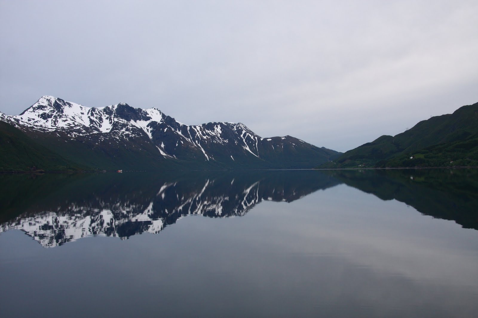
The sun came out for the evening, giving some superb reflections and it was still shining at midnight – we are really beginning to get the midnight sun, a mountain in my way stopped me from seeing if it actually disappeared – going down in the north, which confused me but of course James was right about that!  It is certainly light enough to read all night long without lamps!

Thursday 2nd June 2011 – Ascension Day and holiday in Norway

We were up early as planned to leave around 6.30 to take the tide northwards.  However, a gale warning was out for the area and although the local forecasts for our planned route showed no more than Beaufort 4 – 5 from the south west, which would be behind us, we delay our start by 50 minutes deliberating on whether to return to bed or not.  In the end we decided to have a look but collected from a German, in the motorboat in front of us who was up and has been cruising this area for 20 years, a list of suitable places to dive into if the wind became too strong.  The route today included some of the most challenging navigation so far through narrow twisting leads and it rained for much of the time so the vista of tall snow clad mountains often all around us was virtually blotted out and we did for a short time see gusts of gale force winds but from behind so that it was never uncomfortable and although we could have sailed, the strong winds, winding route through the rocks, poor visibility and rain kept us with the motor running and no sails – what’s new I hear you say!

Scultures by Tranoy Harbour

Tranoy Harbour, old whaling ship on the quay is now a restaurant.
In the end we decided not to do the 100 miles to Narvik but to stop about halfway at Tranoy which had been recommended to us by the German.  55 miles later at 3pm we moored in a small fairly empty marina in the rain.  Tranoy had sounded interesting with sculptures and paintings dotted around the village and a couple of art galleries and a lighthouse 3 kms away with a café.  An hour’s walk in the late afternoon showed that even on an early June bank holiday, albeit in the rain, nothing was open.  There were a few sculptures to be seen but the paintings had obviously been removed for the winter and were not back up.  However, a circular route around a rocky area was well marked with paint blobs and with nice sandy beaches this place is probably lovely in the summer.  In the early evening a couple of small boats went out fishing and they returned with a good catch of cod and one halibut which they said was quite a rare catch, the last one they had caught was 15 months ago, so they were particularly delighted with this fish. 

I had thought we might have spent a day here but the chances of finding the café at the lighthouse open tomorrow are remote, also the old whaling ship restaurant / bar on the quay near us looked very closed up so I think we saw everything that was on offer in early June.

Friday 3rd June 2011 - Narvik

Having seen all the Tranoy has on offer this early in the season, we continued on the 45 miles to Narvik, once again the morning forecast was for strong winds but we only had Beaufort 3 – 4 from the south west, so we were able to motor sail, but the winds were not strong enough to keep us moving at 7 knots and in fact decreased as the morning wore on.  We left in the rain and arrived in the rain and for much of the morning we could hardly make out the mountains that we knew were all around us because of the low mist.
We arrived at Narvik at 3pm and fuelled up, credit cards are not taken and neither would our bank debit card work, luckily we just had enough cash to settle the nearly NOK 2000 bill.  James has since been sent to the ‘hole in the wall’ for more dosh!  We then rushed off to find the Tourist Office, which had not answered an email from this morning or their phones.  It is not now in the blue building in the main street but next to the Railway Station, even though it is sign posted in both directions!  We managed to get to the office just before it closed for the weekend at 4pm.  The girl actually was very helpful, she got us the train times for Sweden as we think we will do this trip on Sunday for something to do whilst we hide from the gales.  However, she confirmed that the cable cars were not open until later in the month.

Although we are very sheltered in our berth here from the strong south westerly wind the tide is rushing in with the wind behind it and we are now beginning to rock!  However, we know Narvik is one of the most sheltered spots in Northern Norway to be at whilst the gales rage.  Our berth in Bodo would have been awful!

I am also pleased to report that my back is much better now.

Monday, 30 May 2011

Bronnoysund - Bodo via the Svartisen Glacier


Thursday 26th May 2011 – OUR AMAZING DAY – Crossing the Arctic Circle & Svartisen Glacier

We left Bronnoysund, which is the mid-point on the Norwegian Coast, at 7 am having filled up with Diesel.  78 nautical miles later at 17.45 we passed the Arctic Circle Monument and a further 3 miles on at 18.03 we crossed the current Arctic Circle at 66N33.44, as given by Google the position of the actual Arctic Circle changes each year with the tilt of the world axis.

Arctic Circle Monument

Crossing the current Arctic Circle

We continued on for a further 27 n.miles to the Svartisen Glacier.  We could see the top of Glacier for many miles as we came up the coast.  The name means black (svart) ice (isen).  

An early view of the Glacier
The Svartisen Glacier is the second largest in Europe covering 370 sq. kilometres, the first largest is Jostedal which is also in Norway.  We chose to visit the Glacier from the Holandsfjord to a part of the Glacier called Engabreen, which has a sub-glacial laboratory beneath it, researching the charges to the Glacier and microbes that live in the environment, all of which is being used by scientists in planetary research of what might be found on places like Mars.
 As we turned the corner of the Holandsfjord and got the first view of the Engabreen finger of the fjord coming down it was a real ‘wow’ moment.  We berthed on the Engen pontoon beneath the Glacier or so it seemed as the woods between us and the Glacier hid the lake in front of the Glacier and it really felt as though you could nearly reach up and touch it.  The first thing we noticed about the pontoon was that it had no walkway off and was just attached by ropes to the bridgehead and a buoy at the other end.  We later learnt that it had broken during the winter and has gone off to be repaired, however, a dinghy has been carefully left (no oars) for visitors to use, soon after our arrival at 10 pm, we watched some crew from a Polish boat that was already on the pontoon pull themselves back from the land using ropes that they had provided, it looked very tippy.  


They had just returned from climbing the rocks to the Glacier.  By 4am when I awoke and took some wonderful photos of the reflections around the Fjord the Polish boat had already left.

Distance motored / sailed: 122 nm


4 am reflections from around the fjord


Friday 27th May 2011 – Our first attempt to reach the head of the Glacier

After a leisurely morning and a cooked brunch we pumped up our red Avon dinghy ‘Marmalade’ and rowed ourselves to the shore – much more stable than the fibreglass dinghy provided.  We walked the mile to the café in front of the lake before the Glacier and on speaking to ‘Madam’ who said both routes to the Glacier were easy but her personal favourite way was through the woods on the right hand side of the lake, which I had already read was the prettiest route, so that decided us to go that way, it was definitely interesting there was a swing bridge across the swirling river (leaving the lake for the Fjord) which I did not enjoy and then we followed various unmarked paths, not knowing whether they were made by man or beast and had to ford a number of streams leading to the lake.  
  

Swing bridge
 
Crossing a stream
Ravine

We then came out near the beach in front of the ravine down from the Glacier, after that it was a climb up rocks with only cairns people had placed to give us any idea of where to go, it was a long way up over streams from the mountainsides, James was becoming more unhappy with the height and incline of the rocks, I was keen to keep going and he managed to follow me until after crossing one steep water course we were faced with an old rope attached to rusty rings at each end which I gave a pull but at that point I also felt enough was enough as the rock was very smooth with few foot or hand holds and although we were really very close the end of the Glacier our nerve failed us.  Getting back down was not that easy – had to slide on our backsides at times and then the walk back through the woods proved difficult and we had to retrace our steps a few times when we reached an area of streams that we could not ford.  Eventually, we got back to the swing bridge and the café where Madam although not really open was happy to have our money and provided us with coffee and cake.  
Cafe by the lake in font of the Glacier

Some of the streams we had to ford!
The whole walk was 6.3 miles and we were disappointed not to have reached the ice of the Glacier.  On returning to the boat we stopped for a chat to the man who runs a little ferry service and he said the route on the left hand side of the lake going up the road was easier.

Saturday 28th May 2011 – Carol reaches the Svartisen Glacier
The end of the Glacier lived up to it's name of black ice, very dirty, other parts vivid blue.
 This morning after brunch we decided to get the bikes out, to cycle the road past Engen Lake.  As the tide was in James was able to put the folded bikes in their bags into the dinghy and just push off from the pontoon across the 6’ to the bridgehead and manhandle the bikes on to the landing stage.  We again rowed to the shore and walked back down the landing stage to collect the bikes and assemble them, the bags were left in the dinghy.

We cycled the 2.2 miles to the end of the road nearest the Glacier and then walked / scrambled our way up the hillside, to begin with the route had a chain handrail to follow, when that ended we carried on following white painted markings on the rocks at the point these ended quite near the ravine taking the Glacier melt water down to the lake, James was again feeling uncomfortable by the height, so I left him sitting on a rock.   
James on his rock
Ravine taken from below the Glacier

I continued on following various cairns and made it to the Glacier and was able to collect ice for our evening drinks.  Soon after I arrived 6 other people made it up to the Glacier so I was able to get someone to take my photo by the Glacier and they confirmed seeing James sitting on his rock.  Whilst standing down by the Glacier pieces of ice where plopping down beside me!  
A blue ice cave taken at the Glacier

The worse part of the climb came on the return journey when I had to make my way back down a shallow 6’ ledge with few hand holds and not being able to see where to put my feet, I nearly froze but there were others behind me wanting to get back, which was just as well as they helped me find the route back, having followed one false trail, James was still sitting waiting for me cross, with himself for being beaten by his fear of heights for not reaching the Glacier.  It was interesting to see the few flowers that grow on the mountainside, were ones that I associate with rock gardens e.g. London’s Pride also there were a lot of tiny yellow mountain pansies, more like violas in size, but my wild flower book identifies them as mountain pansies.


On the way down we watched a bus load of youngsters being dropped at the end of the road who along with some local guides proceeded to climb the mountain but we were interested to see that they took a completely different route far to the left following some red arrows and more rope hand rails which we had not noticed before.  On talking to one girl and then to some of the adult teachers, we heard that this activity was part of a week long get together of children from Norway, France, Belgium, Poland, Czechoslovakia and Bulgaria, whose whole trip had been funded by the EU and this was the second year of the project, now I know where some of our EU money goes!  We knew that a few of the youngster were going to have a chance to walk on the glacier, when they would have to wear crampons and have ice picks and be roped together.  So we watched through binoculars the way the children were taken in case it looked any easier, in the end it looked a lot further and they had go via a hut where the local guides obviously store their equipment and this was still a long way from the edge of the Glacier, eventually after at least 4 hours we saw some of them getting on the ice, strung out like ants even through the binoculars and with the naked eye you could really only make them out when they were grouped together.  We felt rather sorry for the children who had to wait around for those doing the glacier walk as I don’t think the majority even got to touch the ice unless they were prepared to walk quite along way – I only noticed 2 do this.
On our way back down

In front of the cafe looking up to the Glacier
Before returning to the boat we cycled as far round the fjord as we could before coming to a gate and a steep track down hill, which we decided we would not wish to walk up.  However, I had two bits of luck firstly I found a NOK 200 note lying on the track (worth about £25) and then I found wild rhubarb to pick – I had read that it could be found wild on the Islands but this was the first lot I had seen, so I am now enjoying stewed rhubarb which is one of my favourites and James’ hates!

By the time we got back to the boat the tide was along way out, so we decided that we would not risk dropping the bikes over the side of the landing stage into the dinghy so a better option was to take the bikes and the dinghy to the beach which was now exposed and fold the bikes up there and row them back to the pontoon which is what James did and then he came back for me by the rocks closest to the pontoon.

Bike in its bag back to dinghy
Bikes back to boat
That evening we enjoyed Pimms with glacier ice and a young couple (German man and New Zealand girl) arrived in their yacht we gave them a Pimms before they set off to walk to the Glacier at 9 pm back just before midnight, with the constant light you can do these things and the ice on the glacier turned pink in the twilight which is all you get here at the moment.

Sunday 29th May 2011– Bodo

Just before leaving the Svartisen Glacier after breakfast I was in the heads when my back suddenly became agony – I really can’t pin point what I had done differently but suffice it to say I have been in agony ever since.  I was little help to James on the motor round to Bodo (he did have the mainsail up for much of the way, but I don’t think it was doing a lot) and I spent the afternoon in bed with the electric blanket on.  We arrived in the rain and I was only able to give limited help with mooring the boat, it preceded to rain all night.  I think I shall have to find an Osteopath.

The cost of the berth is NOK 150 p.n. which is payable with a credit card at a parking style meter on the shore along with the electricity at NOK 1.75 per kilowatt so far 2 kilowatts have given us 19 hours of power, running the greenhouse type heater all night along with my electric blanket and the immersion heater for 7 hours.  We have also got free internet access from Bodo Guest Harbour which is useful.
Distance motor sailed: 59 nm.   We have now travelled over 1500 nm.

Monday 30th May 2011

A day of doing very little other than a visit to the Tourist Office, who gave me the name of a nearby Osteopath who saw me at 15.30 and has manipulated my back and says it is now aligned correctly, still sore but I think I am moving a bit better - time will tell.  Not much seems to be open here yet - the season does not start for another 3 weeks and today with my back the last thing I want to do is sightseeing, also the weather is very variable - sunshine and heavy showers.  Hopefully, tomorrow I will feel up to taking a load of washing to the machines in the Harbour Office.

Hurtigruten Ferry making a tight turn out of Bodo!
     
An old boat in Bodo

Paddington IV in Bodo


Tuesday 31st May 2011


My back is still painful, but I think a little easier.  I managed to do two loads of washing, once again payment is via credit card NOK 50 each per wash and dry, having paid for two washing machines I now realize that I could have got two loads done of 40 degree washes in one machine as you get the machine for 100 minutes, the driers last for 120 minutes but having given the first load 60 minutes and it was still not dry, I then used the second drier to get my second wash dry.  Therefore, to get two loads washed and dried costs about £25!  This is really a note for anyone else visiting Bodo!  Additionally, if you wish to use the showers you also pay at the same credit card terminal!

Later in the afternoon I found the post office for stamps so at least I know I have the correct amount to put on   postcards and then I did a fresh food shop as I suspect the shops in the Lofoten's will be expensive with limited choice.

Amazingly the 2 kilowatts of electricity that we paid for on our first night (NOK 3.50) is still going strong - I now have a theory that as long as you pay for some electricity is does not really calculate what you are using - I expect most people usually opt to pay for a lot more kilowatts than we did; if that's not the case then the other marinas which charge anything from NOK 50 - 100 per day are thieves!